
Radar remote sensing technologies provide “all-weather” and “all-day” monitoring capabilities with reliable information and extreme accuracy. Such a technologies can be operated in different operative settings and for different aims (monitoring for prevention, early warning, and emergency response). Radar remote sensing makes it possible to collect data of dangerous or inaccessible areas at once (up to a few square kilometers) from a safe distance with very high accuracy on the whole mapped scenario.
Radar remote sensing can be employed in various fields: agriculture, forestry, oceanography, urban planning, transport structure, and in the extractive industry, including the oil and gas industry.
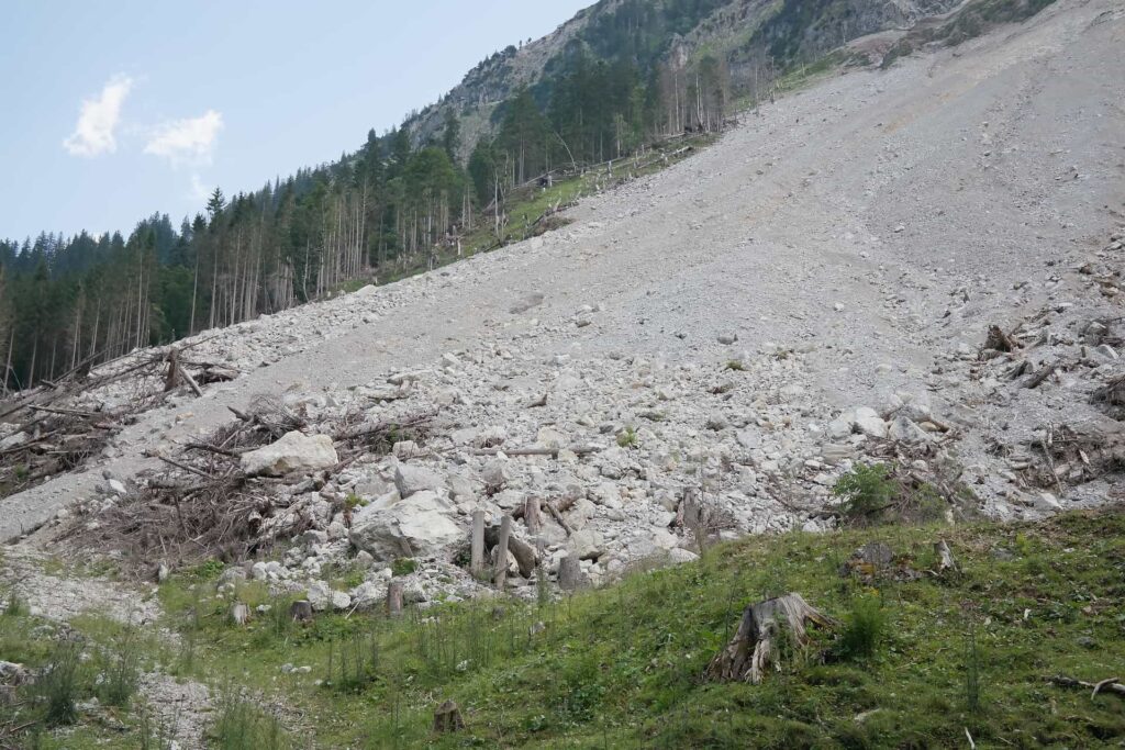
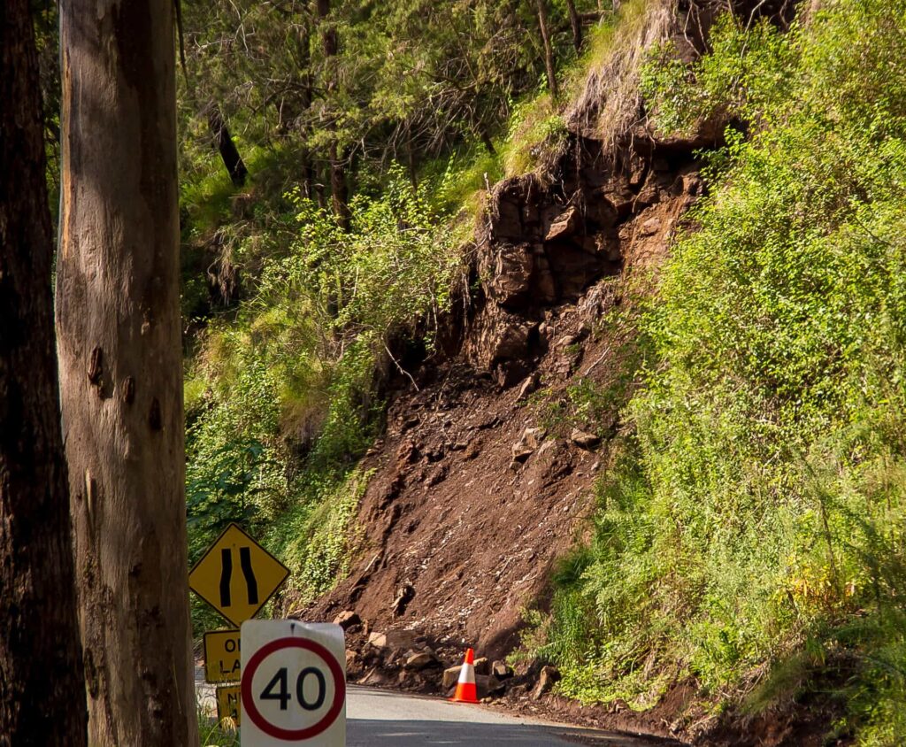
Ground and infrastructure continuous monitoring has become a fundamental task for the planning, management, maintenance of the infrastructures and strategic assets. Landslides, ground subsidence and structural deformations are serious and largely underestimated problems, in Europe and in other areas of the world.
Also in sea environment, the need of detection and monitoring of oil spills, sea waves, currents, sea ice and ships is increasing. The maritime observation with SAR imagery allows the users to support maritime surveillance activities at any time, in all weather conditions both day and night.
ECHOES, since its foundation, has been involved in structural, geotechnical and environmental monitoring applications. ECHOES has a strong experience in Synthetic Aperture Radar (SAR) systems with imaging, interferometric and change detection capabilities from both terrestrial and aerial platforms (UAVs and aircrafts).
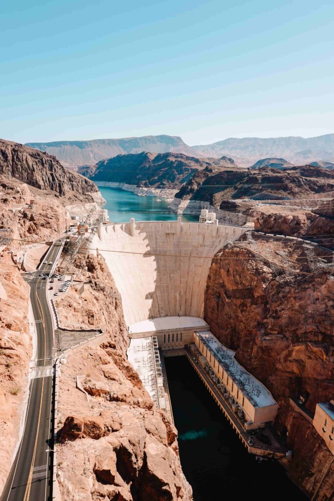
By exploiting interferometric techniques, our radar systems can be employed to measure surface deformations with sub-millimetric accuracy. Main applications are in the framework of ground deformation monitoring, e.g. landslides, ground subsidence, rockfalls, glaciers, avalanches and volcanoes, etc., and Structural Health Monitoring (SHM) of engineering structures such as bridges, buildings, towers, dams, tailings and roads.
The ease of deployment, installation and usability (also in harsh environments) are some of the features that ECHOES guarantees with its radar systems. Our radar systems mount innovative and modular on-board real-time data processing hardware/software that can support any data processing task requested by the specific user need.
ECHOES has also implemented proprietary and powerful software toolboxes to form SAR images from raw radar data. The SAR images can be then post-processed by using several algorithms, e.g. interferometric analysis, coherent and incoherent change detection, time series analysis and oil spill detection.
| Cookie | Durata | Descrizione |
|---|---|---|
| cookielawinfo-checkbox-advertisement | 1 year | Set by the GDPR Cookie Consent plugin, this cookie records the user consent for the cookies in the "Advertisement" category. |
| cookielawinfo-checkbox-analytics | 1 year | Set by the GDPR Cookie Consent plugin, this cookie records the user consent for the cookies in the "Analytics" category. |
| cookielawinfo-checkbox-functional | 1 year | The GDPR Cookie Consent plugin sets the cookie to record the user consent for the cookies in the category "Functional". |
| cookielawinfo-checkbox-necessary | 1 year | Set by the GDPR Cookie Consent plugin, this cookie records the user consent for the cookies in the "Necessary" category. |
| cookielawinfo-checkbox-others | 1 year | Set by the GDPR Cookie Consent plugin, this cookie stores user consent for cookies in the category "Others". |
| cookielawinfo-checkbox-performance | 1 year | Set by the GDPR Cookie Consent plugin, this cookie stores the user consent for cookies in the category "Performance". |
| CookieLawInfoConsent | 1 year | CookieYes sets this cookie to record the default button state of the corresponding category and the status of CCPA. It works only in coordination with the primary cookie. |
| Cookie | Durata | Descrizione |
|---|---|---|
| _ga | 1 year 1 month 4 days | Google Analytics sets this cookie to calculate visitor, session and campaign data and track site usage for the site's analytics report. The cookie stores information anonymously and assigns a randomly generated number to recognise unique visitors. |
| _ga_* | 1 year 1 month 4 days | Google Analytics sets this cookie to store and count page views. |